How to get there - Lower Frankton is about 15 miles northwest of Shrewsbury in the Welsh Borders. See the start map for details. I suggest you drive half a mile or so south from Lower Frankton where there is a small canalside car park which will by pass the Frankton Locks and avoid a portage. But if you don't mind the portage you can start at the Frankton Junction itself. (For those with SatNav the postcode for Frankton Junction is SY11 4PB.)
If you want to leave a car at the finish see the map. For those with SatNav the postcode is SY10 8JB. There is a car park at the coffee shop Canal Central but its always polite to ask.
Get a map with driving directions to
start or
end (enter the postcode of your starting point at A)
Suggested Launch Site - Launch over the bank from the car park.
General
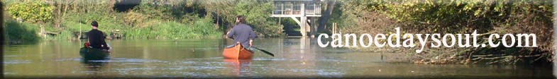
Description - The Montgomery Canal was once the main line of what is the Llangollen Canal (the branch to Llangollen was merely a feeder to supply water).
The route winds through open farmland past Perry Aquaduct and the remains of Rednal Basin. You will pass plenty of examples of industrial archeology.
There is a pub at Queens Head (no prizes for guessing its name) if it suits as as a lunch stop.
The route ends at Maesbury Marsh Canal Central giving an overall trip of 6 miles, 4 locks one aqueduct and a disused canal basin.
The Friends of The Montgomery Canal have Canadian Style Canoes, with equipment, available for use on most of the 35 mile length of the canal. The more that boaters use the canal the better it keeps the weeds down. The canoes are based at Pool Quay and Maesbury and can be borrowed for a donation .Tel:- 01938 590543 or Tel:- 01691 831455.